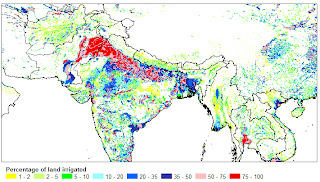
For the GIS-users the map is distributed in two different formats:
- as zipped ASCII-grid that can be easily imported in most GIS-software that support rasters or grids;
- and, to accommodate people who use GIS-software that doesn't support rasters or grids, as a zipped ESRI shape file.
| Projection | Geographic |
| Number of columns | 4320 |
| Number of rows | 2160 |
| North Bounding Coordinate | 90 degrees |
| East Bounding Coordinate | 180 degrees |
| South Bounding Coordinate | -90 degrees |
| West Bounding Coordinate | -180 degrees |
| Cell size | 5 minutes, 0.083333 decimal degrees |
| NODATA values | Cells without irrigation are characterised by NODATA (-9), it does not mean that there was no data for these cells |
Map versions
| Version 5 | - | Global update to map version 5.0 | |
| Version 4.0.1 | - | Irrigation in Africa, Europe and Latin America | |
| Version 4.0 | - | Pre-release of map version 4.0 | |
| Version 3.0 | - | An update for North America | |
| Version 2.2 | - | An update for Asia | |
| Version 2.1 | - | Updates for Africa and Oceania | |
| Version 2.0 | - | An update for Latin America and Europe | |
| Version 1.0 | - | A Digital Global Map of Irrigated Areas |

