NGDC provides stewardship, data, products and services for
geophysical data describing the solid earth, marine, and solar-terrestrial
environment, as well as earth observations from space.
Key Features
and Services:
-
Free Downloadable Data
-
Interactive Map Services
- Metadata Catalog
- Online Data Access Systems
- Products by Media Types
Data categories:
-
Hazards
- Marine
- Satellite
- Snow & Ice
- Solar-Terrestrial
Available Data Types:
Aeromagnetic Data, Aurora, Bathymetry/Topography, Climatology, Coastlines,
Computer Imagery, Cosmic Rays, Defence Meteorological (DMSP), Earthquake, Environmental
Data, GIS Data, GPS (CORS), Geochemistry, Geodetic (GEOSAT), Geographic
Boundaries, Geology, Geomagnetism, Geostationary (GOES), Gravity Data, Great
Lakes, Habitat Characterization, Ionosphere, Magnetic Data, Marine Geology, Marine
Geophysics, Marine Minerals, Marine Sediment and Rock, Marine Seismic
Reflection Data, Marine Well Logs, Multi-beam Bathymetry, Natural Hazards, Ocean
Drilling, Pale-oceanography, Satellite Data, Snow and Ice, Solar Data, Tsunamis
and Volcanology.
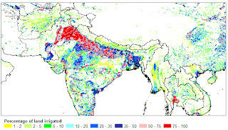
Sample Map 1:
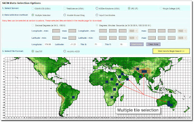
Sample Map 2:
NGDC's data holdings currently
contain more than 400 digital and analog databases, some of which are very
large. As technology advances, so does the search for more efficient ways of
preserving these data.
NGDC works closely with
contributors of scientific data to prepare documented, reliable data sets and
welcoming cooperative projects with other government agencies, nonprofit
organizations, and universities, and encourage data exchange.
The Data Centre continually
develops data management programs that reflect the changing world of geophysics
and welcoming your input to their programs and look forward to supplying your
data needs.


